About
CRA Public File
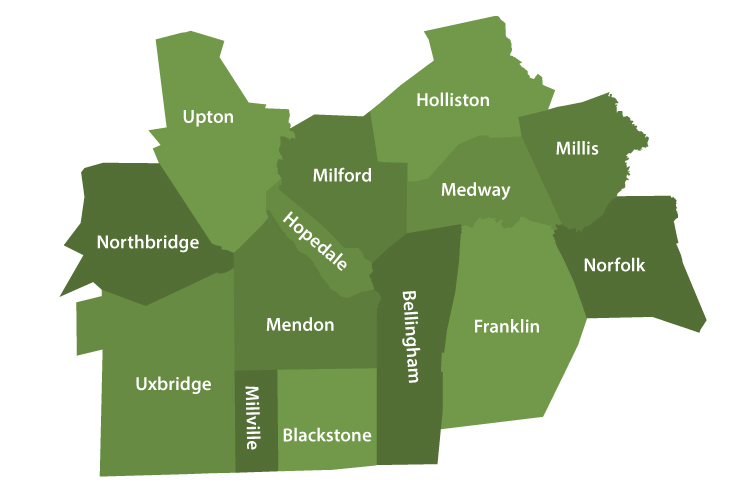
Delineation of Community CRA Area Map
Charles River Bank is a community bank; it was established to support this and surrounding communities. We aggressively seek good loans from within our area and we approve all sound loans that come to us from within our market. Our delineated community is comprised of the following towns: Medway, Millis, Franklin, Milford, Holliston, Norfolk, Bellingham, Mendon, Uxbridge, Blackstone, Millville, Hopedale, Northbridge, and Upton. This designation of community does not preclude our making loans to other areas, but rather delineates where our emphasis and marketing efforts are directed. The map found on the following page graphically depicts our community and the outlined area represents our assessment area. The map also includes the different census tracts within each town, indicated by their assigned census tract number.
The census tracts are as follows:
- BELLINGHAM 4431.03, 4431.04, 4431.05, 4431.06
- BLACKSTONE 7471.01, 7471.02
- FRANKLIN 4421.01, 4421.03 4421.04 4421.05, 4422.01, 4422.03, 4422.04
- HOLLISTON 3871.00, 3872.01, 3872.02
- HOPEDALE 7451.00
- MEDWAY 4081.02, 4081.03, 4081.04
- MENDON 7461.00
- MILFORD 7441.02, 7441.03, 7441.04, 7442.01, 7442.02, 7443.00, 7444.00
- MILLIS 4071.01, 4071.02
- MILLVILLE 7481.00
- NORFOLK 4091.01, 4091.02
- NORTHBRIDGE 7501.00, 7502.00, 7503.00
- UPTON 7431.00
- UXBRIDGE 7491.00, 7492.00
CRA Map